
Big Muddy Speaker Series presents:
A Watershed Case Study - Hinkson Creek to the Gulf

Presentation by Jason Hubbart, PhD, Associate Professor, and Lynne Hooper, The Interdisciplinary Hydrology Lab - University of Missouri School of Natural Resources
This presentation was originally given on Tuesday, April 14, 2015 at Les Bourgeois Vineyards Bistro in Rocheport, MO
Hinkson Creek runs through the heart of Columbia before joining Perche Creek which empties into the Missouri River near Cooper's Landing. This mixed-land-use urban/rural stream watershed, in the midst of ongoing development, is the subject of a multi-year, multi-stakeholder research and restoration project using Collaborative Adaptive Management processes.

Jason Hubbart, PhD, is leading a team of university researchers called the Hinkson Creek Experimental Watershed Project providing water quality data for an adaptive management task force currently working on solving stormwater problems highlighted in EPA Clean Water Act enforcement.
Hubbart will follow our watershed, from the urban Hinkson to the Gulf of Mexico, where decisions being made throughout the watershed are creating a algal blooms and a hypoxic low-oxygen zone commonly called the "Dead Zone". The nutrient pollution causing the Dead Zone is most often blamed on large-scale agricultural practices and runoff, but there are other complex problems involved at many scales. By focusing on the Hinkson Creek, Hubbart will also shed light on how local watershed problems are intertwined with larger watershed issues.
He'll also be joined by graduate student Lynne Hooper, who is doing a site analysis study up and down the entire Hinkson watershed. She'll be sharing a video she made tracking the condition of the stream.
Jason Hubbart is Associate Professor of Forest Hydrology and Water Quality at The Interdisciplinary Hydrology Lab - University of Missouri School of Natural Resources. Additional titles - Director of the Center for Watershed Management and Water Quality; Co-Lead South Eastern Region Association (SERA-46) of Land Grand Universities and the Gulf Hypoxia Task Force; Superintendent, Baskett Wildlife Research & Education Center (Ashland, MO)
Extended Abstract submitted by Hubbart:
Annually, the United States grows more than one-third of the corn and soybeans in the World and much of this production is in the Mississippi River Basin (MRB) (USDA-National Agricultural Statistics Service). More than 70% of the nitrogen and phosphorus delivered to the Gulf of Mexico is associated with agricultural activities. However, multiple and mixed-land use practices, including urbanization, also provide growing impact. High nutrient loads, loss of floodplains and wetlands, population growth, anthropogenic changes to the landscape, increased combustion of fossil fuel, engineering of the river system, and point sources provide a complex interacting suite of causes of water quality problems in the MRB, hypoxia in the Gulf of Mexico, and a decline in the assimilative capacity and resilience of these ecosystems. In the United States, many states have developed, or are in the process of developing, best management practice (BMP) guidelines on how to reduce agricultural impacts on water quality while sustaining productivity and profitability. However, there is a great deal of work to be done considering most watersheds are now managed for many (i.e. mixed) different land use objectives.
Mixed-land use watersheds comprise the majority of drainages in the MRB and typically include a continuum of forested, agricultural, and urban land-uses. The Hinkson Creek Watershed (HCW) is a large mixed-land use urbanizing catchment (231 km2) located in central Missouri. A long-term scale-nested watershed study, consisting of five permanent hydroclimate stations, was established in 2009 to provide science-based information regarding the effects of land use on hydrologic and water quality regimes (see map above). Results from a number of completed and ongoing studies will be presented that are beginning to highlight the complex mosaic of anthropogenic land-use issues of inland-upland processes lending to Gulf Hypoxia. Project results are helping to guide local and regional watershed policy decisions, provide scientific support to assist future urban land management decisions, and improve understanding of mid-Missouri contributions to nutrient loading in the Gulf Coast of the United States.
Meet Your Presenters
Related Presentations
Resources & Links
Upcoming Presentations

Missouri River Relief: 25 Years on the Big Muddy
November 10, 2026Columbia, MO
Join us for a journey through time celebrating 25 years of Missouri River Relief's work on the Big Muddy.
See Event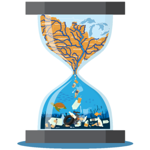
Plastic Pollution, Gulf Hypoxia, and Water Quality
November 11, 2026St Charles, MO
Jennifer Wendt from MidAmerica Clean Future guides us through understanding regional water quality challenges.
See Event